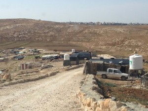
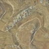
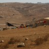
At the outskirts of Yatta, partially on Area B and Area C
Wadi Rakhim
Resident
Number of Families
25
Names of Families
Abu Malash, Sunnaran, Hreini
Farmers Origin/Family
From Susya and Al Qaryitein
Refugees
non-official refugee status
Refugees Details
Not recognized as refugees because they continue to live on their historical lands
Spatial/Building
Land Ownership
private
Planning
submitted plan
Planning - details
A plan was made and submitted by IPCC, with funding from the PA. It was rejected by the ICA
Structure Type
- tent
- tin shack
- concrete
- wood
Building materials - details
Concrete structures are only in area B
Infrastructure/Services
Access to Community
- pedestrian
- private vehicle
Water Access
- water tank
- cistern\well
Water Access - details
There are wells that collect water in the winter. Each family has one or two wells. In the summer they buy water tanks from A-Tuwani or Yatta. An annual project was donated buy GVC to offer water for low prices , but the project did not operate in 2019..
Electric Connection
Health Care
- permanent clinic in community
- mobile clinic in community
- clinic in distant town/village
Health Care - details
A mobile clinic funded by the PA visits the community. The closest hospital is the governmental hospital in Yatta
Location of Services
A-Tuwani, Yatta and Hebron.
Education
Kindergarten
No
Location of School #1
Wadi Rakhim
general description [school #1]
- Boys
- Girls
- Primary school
Distances to schools [school #1]
301 - 1000 meter
Location of School #2
Wadi Rakhim
Time to schools [school #1]
5 - 15 minutes
general description [school #2]
- Boys
- Girls
- Middle school
Time to schools [school #2]
5 - 15 minutes
Distances to schools [school #2]
301 - 1000 meter
Location of School #3
A-Tuwani
general description [school #3]
- Boys
- Girls
- High School
Distances to schools [school #3]
more than 5001 meters
Time to schools [school #3]
16 - 30 minutes
Travel to school [school #1]
- easy walk
- donkey
Travel to school [school #2]
- easy walk
- donkey
Travel to school [school #3]
- bus
- donkey
Accessibility to school [school #1]
3
Accessibility to school [school #2]
3
Accessibility to school [school #3]
6
History
History
The community was expelled from Al Qaryitein in 1948 to Susya. They were forcibly removed from in 1985 from Susya. They own the lands they sit on today since before 1948, which doesn't allow them to get refugee status.
livelihood
Seasonal Movement
no
Community Initiatives
- water
- elec'
- woman employment
Other Occupation
- shepherding
- temporary employment in Israel
- agriculture
Main Occupation
- shepherding
- agriculture
Woman's Occupation
- taking care of the herd
- taking care of the kids
- housekeeping
General Livelihood - details
Women from the community also receive loans from USAID with the help of which they invest in different projects. Some bought sheep, chickens, and bee hives.
Threats and obstacles
Threats and Obstacles
fjfxjsfjsyjsyj
- nature reserve
- close to settlement
- settler violence
- road
Threats and Obstacles - details
The community lives in great proximity to a military outpost and the archaeological site of Susya, both of which restricts their movement and grazing lands.
Demolitions - details
The community is under consistent demolition threat since the 90's.

