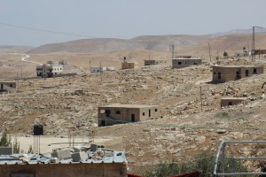
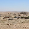
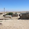
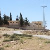
South Hebron Hills, adjacent to settlement of Karmel
Um al Kheir al Faqir
Resident
Number of Families
100
Tribe
testing the tooltip
Jahalin
Sub-Tribe
Al-Hathalin
Names of Families
Azazme, Hathaleen, Tabneh, Al Faqir
Refugees
- official refugee status
- Unknown
Refugees Details
60% of the community are recognized as refugees by UNRWA
Spatial/Building
Land Ownership
private
Planning
Demarcation plan
Planning - details
Demarcation plan was approved around 1982. However there are structures that were built outside the demarcation area.
Structure Type
- tent
- tin shack
- concrete
Infrastructure/Services
Access to Community
private vehicle
Access to Community - details
There is no paved road leading to the community. No public transport reaches the area.
Water Access
- authorized connection
- cistern\well
Water Access - details
The community was connected to the Israeli water system in 1970. The connection was updated in 1984. The water stream is weak during the summer. Some inhabitants own wells. There is no sewage system in the community.
Electric Connection
Electric Connection - details
Connected to the Israeli electricity network since 2010.
Health Care
- mobile clinic in community
- clinic in distant town/village
Health Care - details
A clinic within the community offers services one day a week. During the rest of the time the community uses the hospital in Yatta.
Location of Services
Yatta and Hebron
Education
Location of School #1
Um al Kheir
general description [school #1]
- Boys
- Girls
- Primary school
- Middle school
- High School
Schools - details
In 2015 there was a plan to build a school for girls, with support from a foreign NGO
Accessibility to school [school #1]
2
History
History
Most of the population are refugees from Tel Arad, Be'er Sheva and they are recognized as refugees. The rest have lived in the area since before 1948, in caves.
livelihood
Community Initiatives
- water
- elec'
- public building
Initiative in the community - details
The local council managed to connect the community to water and electricity and to build the school
Other Occupation
- shepherding
- temporary employment in Israel
Main Occupation
- shepherding
- temporary employment in Israel
General Livelihood - details
Grazing areas are available only in the east, as in the west the proximity to the settlement restricts the grazing areas
Threats and obstacles
Threats and Obstacles
fjfxjsfjsyjsyj
- firing zone/closed military zone
- close to settlement
Threats and Obstacles - details
Grazing areas are available only in the east, as in the west the proximity to the settlement restricts the grazing areas
Number of Demolition Orders
8
Number of Demolitions
0
Demolitions - date of update
September 17, 2010
Demolitions - details
According to residents, no demoltions took place in this community and there are no visits from the ICA.

