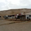
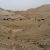
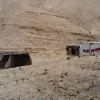
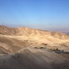
Jerusalem periphery, south of Road 1
Sateh al Bahr
Resident
Number of Families
17
Tribe
testing the tooltip
Jahalin
Sub-Tribe
Saray'a
Names of Families
Hammadin
Refugees
official refugee status
Spatial/Building
Land Ownership
Waqf
Land Ownership - details
The lands are Waqf Lands that are part of Nabi Musa. part of them are declared as closed military zones
Planning
community initiative plan
Planning - details
Bimkom has prepared a plan with the help of the community members. It was submitted to the court as part of an appeal.
Structure Type
- tent
- tin shack
- EU shack
- wood
Infrastructure/Services
Access to Community
- pedestrian
- private vehicle
- 4X4 vehicle
Access to Community - details
A dirt road leads from the community to Jericho. It is unpaved and rugged. In the winter the road gets flooded and the access to the community is blocked.
Public transport is not allowed to stop in the main road near the community.
For everyday services women have to cross the barrier in the middle of the main road, and then to jump above or below the metal barrier on the sides of the road, along with their shopping and babies or young children.
Public transport is not allowed to stop in the main road near the community.
For everyday services women have to cross the barrier in the middle of the main road, and then to jump above or below the metal barrier on the sides of the road, along with their shopping and babies or young children.
Water Access
- water tank
- connection to neighboring village
Water Access - details
They are connected to 'The good Samaritan' with a 5 km long pipe since 2012, but the water that come through this connection are insufficient. A connection to Khan Al Ahmar provides water but is also not sufficient, and it reaches hot, so they also buy water tanks.
Electric Connection
Electric Connection - details
They have solar panels since 2014, but they are hardly functioning. They are receiving new ones soon.
Health Care
- mobile clinic in community
- clinic in distant town/village
Health Care - details
There is no clinic in the area, and a mobile clinic arrives once a month. The nearest clinics are in Al-Eizariya and the nearest hospitals are in Jericho , Almaqased in Jerusalem, and Ramallah.
Location of Services
Jericho
Education
Kindergarten
yes
Kindergarten - details
Two women from the community run the kindergarten voluntarily, with the help of Aziza Sisters organization.
Location of School #1
Aqbet Jabr, Jericho
general description [school #1]
- Boys
- Girls
- Primary school
- Middle school
- High School
Distances to schools [school #1]
more than 5001 meters
Location of School #2
Jericho
Time to schools [school #1]
over 1 hour
general description [school #2]
- Boys
- Middle school
- High School
Time to schools [school #2]
over 1 hour
Distances to schools [school #2]
more than 5001 meters
Location of School #3
Jericho
general description [school #3]
- Girls
- Middle school
- High School
Distances to schools [school #3]
more than 5001 meters
Time to schools [school #3]
over 1 hour
Schools - details
Some continue to higher education in the University in Abu Dis
Travel to school [school #1]
- bus
- difficult walk
Travel to school [school #2]
- bus
- difficult walk
Travel to school [school #3]
- bus
- difficult walk
Accessibility to school [school #1]
7
Accessibility to school [school #2]
7
Accessibility to school [school #3]
7
History
History
The community arrived to the area first in 1920 for seasonal grazing (Izbeh) in Wadi Qteiff and Hathroura. After their expulsion from the Negev in 1948 they moved in the desert through Wadi Qteiff, until they finally settled in their current location in 1983, over Waqf lands.
livelihood
Seasonal Movement
partly
Seasonal Movement - details
The shepherds from some families leave for short seasonal grazing (Izbeh) in wadi Mqullique during the winter and to longer Izbeh in the suburbs of Ramallah during the summer.
Community Initiatives
- public building
- tourism
Initiative in the community - details
A tourism project is run by the community, providing meals, tours in the dessert and night tours.
The women are trying to find some help to initiate a women employment and empowering project.
The women are trying to find some help to initiate a women employment and empowering project.
Other Occupation
- shepherding
- herd without shepherding
- temporary employment in Palestinian town
- employed by PA
- tourism
Main Occupation
- shepherding
- employed by PA
Woman's Occupation
- taking care of the herd
- taking care of the kids
- housekeeping
- teachers/kindergarten teachers
- herd products
General Livelihood - details
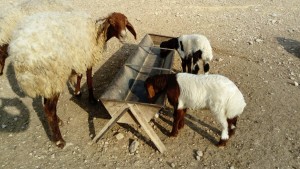
The community owns about 1,140 sheep. The grazing areas are resricted and the routes between the different areas are difficult for sheep.
There is a tourism project in the community.
Some women from the community sell milk products in Al-Eizariya and Abu-Dis
There is a tourism project in the community.
Some women from the community sell milk products in Al-Eizariya and Abu-Dis
Threats and obstacles
Threats and Obstacles
fjfxjsfjsyjsyj
- firing zone/closed military zone
- close to settlement
- road
Threats and Obstacles - details
The ICA restricts building in the area under the claim that it is part of a military zone. The grazing areas are restricted by surrounding settlements and when the army uses the grounds for training.
The lack of public transportation makes it very hard to reach services like shopping and health care.
The dirt road leading to the community gets flooded and destroyed every winter preventing access.
The lack of public transportation makes it very hard to reach services like shopping and health care.
The dirt road leading to the community gets flooded and destroyed every winter preventing access.
Number of Demolition Orders
21
Number of Demolitions
0
Demolitions - date of update
September 17, 2010
Demolitions - details
The ICA restricts building in the area under the claim that it is part of a military zone. No demolitions took place according to the inhabitants but there were some confiscations of mobile structures

