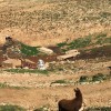
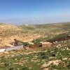
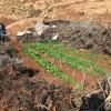
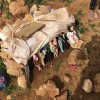
Central West Bank, Northwest of Jericho, along Road 458
Ras A Tin
Basic info+
Resident+
Sub-Tribe
Zweidin
Names of Families
Irsheidat, Abu Rashid
Farmers Origin/Family
Samoua'
Refugees
- not refugee
- official refugee status
Spatial/Building+
Land Ownership
- private
- lease
Land Ownership - details
There are agreements between the owners from Kufur Malek and Mughayir and the community about the lease of the lands.
Planning
No plan
Planning - details
A few application for building permits were submitted
Structure Type
- tent
- tin shack
Building materials - details
They have some barracks for animal hair
Infrastructure/Services+
Access to Community
- pedestrian
- private vehicle
- 4X4 vehicle
Water Access
- water tank
- cistern\well
Water Access - details
The community fills their water tanks in the Ein Samia filling point. Three and a half cubes of water costs 60 NIS, yet this prices goes up in the winter when the access to the community becomes more difficult.
Electric Connection
Health Care
clinic in distant town/village
Health Care - details
The nearest clinics are in Silwad and Turmusa'ya. The nearest hospital is in Ramallah.
Location of Services
Kufur Malek and Mughayir
Education+
Kindergarten
No
Location of School #1
Mghayyir
general description [school #1]
- Boys
- Girls
- Primary school
Distances to schools [school #1]
more than 5001 meters
Location of School #2
Mghayyir
Time to schools [school #1]
31 minutes - 1 hour
general description [school #2]
- Boys
- Girls
- Middle school
Time to schools [school #2]
31 minutes - 1 hour
Distances to schools [school #2]
more than 5001 meters
Location of School #3
Mghayyir
general description [school #3]
- Boys
- Girls
- High School
Distances to schools [school #3]
more than 5001 meters
Location of School #4
Kufur Malek
Time to schools [school #3]
31 minutes - 1 hour
general description [school #4]
- Boys
- Girls
- High School
Distances to schools [school #4]
more than 5001 meters
Time to schools [school #4]
31 minutes - 1 hour
Travel to school [school #1]
- bus
- difficult walk
Travel to school [school #2]
- bus
- difficult walk
Travel to school [school #3]
- bus
- difficult walk
Travel to school [school #4]
- difficult walk
- private car
Accessibility to school [school #1]
6
Accessibility to school [school #2]
6
Accessibility to school [school #3]
6
History+
History
The community was displaced in 1968 from the area of Um Daraj as the entire agricultural area was declared a military training area. Some members of the community went to Yatta area. The rest of the community were forced to move several times since the 70's, as military bases and settlements grew in the area, particularly the settlement of Kokhav Hashahar. They settled in their current location in 2000 permanently.
The families from As Samoua' came in 1998 to west Ramallah and then moved to the eastern side to Ras A tin.
The families from As Samoua' came in 1998 to west Ramallah and then moved to the eastern side to Ras A tin.
livelihood+
Seasonal Movement
yes
Seasonal Movement - details
During the winter the community stays in the eastern side of the hill, and in the summer they move to the north-western side, east of the quarry and Kokhav Hashahar.
Community Initiatives
no Initiatives
Other Occupation
shepherding
Main Occupation
- shepherding
- temporary employment in settlement
- temporary employment in Palestinian town
- daily laborer
Woman's Occupation
- taking care of the herd
- taking care of the kids
- housekeeping
Threats and obstacles+
Threats and Obstacles
fjfxjsfjsyjsyj
- firing zone/closed military zone
- settler violence
- quarry
Threats and Obstacles - details
The quarry nearby creates dust and air pollution. The community also reports violence from settlers. Road 458 is a dangerous crossing point on the way to Kufur Malek.
Number of Demolition Orders
23
Number of Demolitions
11
Demolitions - date of update
September 17, 2010

