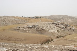
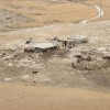
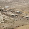
South Hebron Hills, south of Adh Dhahiriya
Khirbet ar-Rahwa
Resident
Number of Families
20
Names of Families
Jabaren , Abu Sharekh , Samamreh
Farmers Origin/Family
Dhahiriya
Refugees
not refugee
Spatial/Building
Land Ownership
- private
- lease
Planning
community initiative plan
Planning - details
In the past they started a plan but they didnt submit it
Structure Type
- tin shack
- concrete
Infrastructure/Services
Access to Community
private vehicle
Water Access
water tank
Electric Connection
Electric Connection - details
The NGO Arij installed solar panels in April/ May of 2015.
Health Care
clinic in neighboring community
Health Care - details
Clinics are located in Shweike and Dhahiriya.
Location of Services
Hebron
Education
Kindergarten
No
Kindergarten - details
Dhahiriya
Location of School #1
Dhahiriya
general description [school #1]
- Boys
- Girls
- Primary school
- Middle school
- High School
Distances to schools [school #1]
more than 5001 meters
Location of School #2
Dhahiriya
Time to schools [school #1]
over 1 hour
Time to schools [school #2]
over 1 hour
Distances to schools [school #2]
more than 5001 meters
Location of School #3
Dhahiriya
Distances to schools [school #3]
more than 5001 meters
Time to schools [school #3]
over 1 hour
Distances to schools [school #4]
more than 5001 meters
Time to schools [school #4]
over 1 hour
Schools - details
Schools are located in Dhahiriya. Many families, especially those who have children in primary school, are worried about sending their young children on the difficult walk to school and send their mothers or sisters to live in Dhahiriya with the children. Since the closure of the road in 2000 they need to drive for about 15 kilometers or walk for 5 kilometers.
Travel to school [school #1]
- difficult walk
- private car
Travel to school [school #2]
- difficult walk
- private car
Travel to school [school #3]
- difficult walk
- private car
Travel to school [school #4]
- difficult walk
- private car
Accessibility to school [school #1]
8
Accessibility to school [school #2]
8
Accessibility to school [school #3]
8
Accessibility to school [school #4]
8
History
History
The community is originally from Dhahiriya.
livelihood
Seasonal Movement
no
Community Initiatives
no Initiatives
Other Occupation
- shepherding
- agriculture
Main Occupation
shepherding
Woman's Occupation
- taking care of the herd
- taking care of the kids
- housekeeping
General Livelihood - details
The community owns about 2000 sheep and they make cheese and milk, which are sold in Hebron and Dhahiriya. Grazing areas are to the east, but have been severely restricted by the settlement of Tene and the Mor Farm outpost.
Threats and obstacles
Threats and Obstacles
fjfxjsfjsyjsyj
- settler violence
- road
- military tower
Threats and Obstacles - details
The outpost of Mor Farm, which is a single-man settlement, is particularly aggressive in driving the shepherds away and controlling their lands.
The military tower is monitoring the movement of the resident and the visitors. During the second Intifada the road connecting Dhahiriya with Bir Esabea' (Be'er Sheva) was closed, which tripled the distance between the community and their home town.
The military tower is monitoring the movement of the resident and the visitors. During the second Intifada the road connecting Dhahiriya with Bir Esabea' (Be'er Sheva) was closed, which tripled the distance between the community and their home town.
Number of Demolition Orders
55
Number of Demolitions
38
Demolitions - date of update
September 17, 2010
Demolitions - details
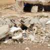
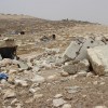
According to residents, the last demolition took place in 2014. According ICA data , demolitions took place as recent as 2016.

