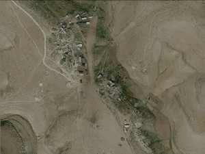
South Hebron Hills, inside Firing Zone 918
Halaweh
Resident
Number of Families
22
Tribe
testing the tooltip
Unknown
Names of Families
Abu Aram
Refugees
not refugee
Spatial/Building
Land Ownership
private
Planning
No plan
Structure Type
concrete
Infrastructure/Services
Access to Community
- pedestrian
- private vehicle
- 4X4 vehicle
Water Access
authorized connection
Water Access - details
The water connection was procured by the local council and the organization ACP.
Electric Connection
Electric Connection - details
Solar panels from Comet ME.
Health Care
clinic in neighboring community
Health Care - details
There are clinics in Jinba and Beita
Location of Services
Yatta
Education
Kindergarten
No
Location of School #1
Al Fatih
general description [school #1]
- Boys
- Girls
- Primary school
- Middle school
- High School
Distances to schools [school #1]
2001 - 5000 meters
Location of School #2
Yatta
Time to schools [school #1]
31 minutes - 1 hour
general description [school #2]
- Boys
- Girls
- Primary school
- Middle school
- High School
Time to schools [school #2]
31 minutes - 1 hour
Distances to schools [school #2]
2001 - 5000 meters
Travel to school [school #1]
- difficult walk
- donkey
Travel to school [school #2]
- difficult walk
- donkey
Accessibility to school [school #1]
4
Accessibility to school [school #2]
4
History
History
Halaweh was established during the Ottoman era.
livelihood
Seasonal Movement
no
Community Initiatives
Unknown
Other Occupation
shepherding
Main Occupation
shepherding
Woman's Occupation
- taking care of the herd
- housekeeping
Threats and obstacles
Threats and Obstacles
fjfxjsfjsyjsyj
- firing zone/closed military zone
- close to settlement
- settler violence
Number of Demolition Orders
30
Demolitions - details
3


