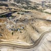
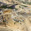
Jerusalem periphery, adjacent to Al Eizariyya
Jabal al Baba
Resident
Number of Families
55
Tribe
testing the tooltip
- Jahalin
- Tarabin
- Tarabin
Sub-Tribe
Salamat, Tarabin
Names of Families
Sayayleh, Hirsh,Abu Freihah, Bseisat, Abu Oweidah, Mazara'a, Tarabin
Refugees
official refugee status
Spatial/Building
Land Ownership
- private
- lease
- state owned land
- not enough data
Land Ownership - details
The total size of the land is about 2500 dunum. approx. 400 of it are state-owned lands, the rest is private-owned or belongs to Al-Eizariya. Some of the lands were confiscated.
About 43 dunums belong to the Vatican church- .
About 43 dunums belong to the Vatican church- .
Planning
- submitted plan
- tourism plan
Planning - details
The recent version of the plan for the community was submitted in September 2019.
Structure Type
- tent
- tin shack
- EU shack
- concrete
- wood
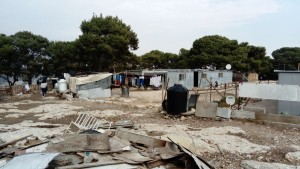
Building materials - details
The public buildings (kindergarten, clinic and women center) are eco friendly.
Infrastructure/Services
Access to Community
- pedestrian
- private vehicle
Access to Community - details
The village was included on the Israeli side of the separation barrier, while the access leading to the village remained on the Palestinian side. The construction of the barrier has not yet been completed but its completion will interrupt the only access road to the village and prevent access in and out of the community
Water Access
connection to neighboring village
Water Access - details
From Al-Eizariya
Electric Connection
Electric Connection - details
From Al-Eizariya by a new net, but it is sufficient and is for low consumption use only.
Recently connected to Al-Eizarya by Electric line with a project by donation.
Recently connected to Al-Eizarya by Electric line with a project by donation.
Health Care
permanent clinic in community
Health Care - details
The clinic, which was recently built, operates once a weak. The staff is external.
Location of Services
Al-Eizariya
Education
Kindergarten
yes
Kindergarten - details
Built by agreement with the Vatican, along with women center and clinic on the Vatican Land. serves about 8 children of the community, run by local women.
Location of School #1
Al-Eizariya
general description [school #1]
- Boys
- Primary school
- Middle school
- High School
Distances to schools [school #1]
2001 - 5000 meters
Location of School #2
Al-Eizariya
Time to schools [school #1]
31 minutes - 1 hour
general description [school #2]
- Boys
- Primary school
- Middle school
- High School
Time to schools [school #2]
31 minutes - 1 hour
Distances to schools [school #2]
2001 - 5000 meters
Schools STAFF - details
They come from Al Eizariyya mostly.
Travel to school [school #1]
difficult walk
Travel to school [school #2]
difficult walk
Accessibility to school [school #1]
6
Accessibility to school [school #2]
6
Accessibility to school - STAFF [school #1]
2
Accessibility to school - STAFF [school #2]
2
History
History
Expelled in 1948 from Tel Arad, most of the community settled in this area during the 50's. The area was used by the community before 1948 for seasonal grazing during the summer (Izbeh), and they used to use the caves for shelter (which are still being used by Mazara'a family until today).
Some came following their neighbors or relatives in the area.
Some came following their neighbors or relatives in the area.
livelihood
Seasonal Movement
no
Seasonal Movement - details
not any more. only to the caves on the eastern side of the hill.
Community Initiatives
- public building
- employment
- woman employment
- tourism
Initiative in the community - details
B&B project run by the community, on the land of the Vatican.
A project empowering women, teaching recycling and re-building is promoted by CORVA (a German NGO). The women also make, embroidery and accessory making.
Oxfam is promoting a film making/ socia
A project empowering women, teaching recycling and re-building is promoted by CORVA (a German NGO). The women also make, embroidery and accessory making.
Oxfam is promoting a film making/ socia
Other Occupation
- shepherding
- temporary employment in settlement
- daily laborer
- unemployed
- tourism
Main Occupation
- shepherding
- daily laborer
- unemployed
Woman's Occupation
- taking care of the kids
- teachers/kindergarten teachers
- agriculture
General Livelihood - details
Grazing ground was scaled down due to the separation barrier and the road leading to Ma'ale Adumim. Today some members of the community work in factories in Ma'ale Adumim and Al-Eizariya. They also sell meat and dairy products in Al-Eizariya. High unemployment rates.
They currently own about 600 sheep/ goats in total, while in the past they had 3000.
A small local Tourism B&B operates in the community.
They currently own about 600 sheep/ goats in total, while in the past they had 3000.
A small local Tourism B&B operates in the community.
Threats and obstacles
Threats and Obstacles
fjfxjsfjsyjsyj
- close to settlement
- within settlement municipal boundary
- within settlement plan
- separation barrier
- road
- Delimitation Order
Threats and Obstacles - details
The route of the separation barrier, when and if completed, will separate the community from Al-Ezariya and will cut their only entrance.
E1 plan is covering most of the community's structures.
The new plan for the peace road planned to pass to the west of the community will block their connection to the Al-Eizariyya.
The new Delimitation Order, which includes most of the structures in the locality, doesn't allow any normal living since it prevents any change on the ground.
Number of Demolition Orders
58
Number of Demolitions
9
Demolitions - date of update
September 17, 2010
Demolitions - details
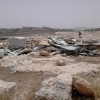
According to the community, in 2016 11 structures which were replaced by caravans were demolished, but some of them were allowed to rebuild the previous structures once again. In total 19 structures were demolished until 2018. The public center for women, kindergarten, and clinic were demolished 3 times at least.

