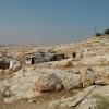
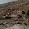
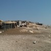
Jerusalem periphery, adjacent to Al Eizariya, southwest to Ma'ale Adumim
Abu Nuwar
Resident
Number of Families
128
Tribe
testing the tooltip
Jahalin
Sub-Tribe
Saray'a, Salamat
Names of Families
Hammadin, Freihat, Kurshan, Bseisat
Refugees
official refugee status
Spatial/Building
Land Ownership
- expropriation
- lease
- private
- state owned land
Land Ownership - details
Some lands are privately owned by people from Abu-Dis
Planning
- community initiative plan
- submitted plan
Planning - details
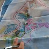
A plan of the community and planning guidelines were submitted in 2015 to the ICA. There were no official responses to the plan.
Structure Type
- EU shack
- tent
- tin shack
- wood
Building materials - details
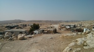
The community has winter and summer housing, made of different materials. The winter homes are made of zinc plate or hard plastic while the summer houses are made of fabrics and light plastic.
Infrastructure/Services
Access to Community
- pedestrian
- private vehicle
Access to Community - details
An exit from Road 3982 leading to Qedar settlement, through a dirt road leading to the community. Access is difficult in winter. There is no public transportation. The community has to walk through Al-Jabal to reach the main road in Al-Eizariya.
Water Access
connection to neighboring village
Water Access - details
Connection from Al-Jabal, but the tiny pipes hardly supply water in summer, and the water reached the community hot. Pipes are in very poor condition.
Electric Connection - details
Connected to a few small businesses Al-Eizariya. They pay more than the actual price of electricity. They also have a few solar panels.
Health Care
- clinic in distant town/village
- mobile clinic in community
Health Care - details
A mobile clinic comes twice a month. The nearest clinics are n Al-Eizariya. The nearest hospitals are in Jericho
Location of Services
Al-Eizariya and Al-Jabal
Education
Kindergarten
yes
Kindergarten - details
There are two kindergartens in the community, both were demolished more than once.
Location of School #1
Abu Nuwar
general description [school #1]
- Boys
- Girls
- Primary school
Distances to schools [school #1]
0-300 meter
Location of School #2
Arab Jahalin (Al-Jabal)
Time to schools [school #1]
under 5 minutes
general description [school #2]
- Boys
- Girls
- Middle school
- Primary school
Time to schools [school #2]
16 - 30 minutes
Distances to schools [school #2]
301 - 1000 meter
Location of School #3
Wadi Abu Hindi
general description [school #3]
- Boys
- Girls
- Middle school
- Primary school
Distances to schools [school #3]
more than 5001 meters
Location of School #4
Al-Eizariya
Time to schools [school #3]
over 1 hour
general description [school #4]
- Boys
- High School
- Middle school
Distances to schools [school #4]
2001 - 5000 meters
Location of School #5
A-Eizariya
Time to schools [school #4]
31 minutes - 1 hour
general description [school #5]
- Girls
- High School
- Middle school
Distances to schools [school #5]
2001 - 5000 meters
Time to schools [school #5]
31 minutes - 1 hour
Schools - details
In 2015 the community established a school for the first and second grades, with the hope of expanding it to higher grades as well. They received some funding from the PA for the project.
Access to schools in Al-Eizariya is difficult as they have to walk to the main street and then take public transportation
Access to schools in Al-Eizariya is difficult as they have to walk to the main street and then take public transportation
Travel to school [school #1]
easy walk
Travel to school [school #2]
easy walk
Travel to school [school #3]
- difficult walk
- donkey
Travel to school [school #4]
- bus
- difficult walk
Travel to school [school #5]
- bus
- difficult walk
Accessibility to school [school #1]
1
Accessibility to school [school #2]
1
Accessibility to school [school #3]
6
Accessibility to school [school #4]
2
Accessibility to school [school #5]
2
Accessibility to school - STAFF [school #1]
2
Accessibility to school - STAFF [school #2]
1
Accessibility to school - STAFF [school #3]
7
Accessibility to school - STAFF [school #4]
1
Accessibility to school - STAFF [school #5]
1
History
History
After they were expelled from the Negev in 1948, the community came to this area searching for grazing lands. The location was close to the main towns, affording services and a market to sell dairy products, but also had good access to grazing lands and water resources at the time. Today both access to the towns and to grazing lands is restricted.
livelihood
Seasonal Movement
partly
Seasonal Movement - details
Some shepherds stay near Wadi al-Waj during the summer months . The rest have to stay over the night in the grazing area, to prevent the danger of crossing the small tunnel beneath the street in order to reach grazing lands
Community Initiatives
- agriculture
- woman employment
Initiative in the community - details
Some small businesses
Other Occupation
- daily laborer
- permanent employment in Palestinian town
- shepherding
- unemployed
Main Occupation
- herd without shepherding
- permanent employment in Palestinian town
- shepherding
Woman's Occupation
- housekeeping
- taking care of the herd
- taking care of the kids
General Livelihood - details
Some are shepherds and some work in Al-Eizaryia.
Threats and obstacles
Threats and Obstacles
fjfxjsfjsyjsyj
- close to settlement
- Dump site
- firing zone/closed military zone
- road
- separation barrier
- within settlement municipal boundary
- within settlement plan
Threats and Obstacles - details
Abu-Dis dump site creates very bad smells and pollutes the air and water.
Harsh restriction do not allow any change in the existing buildings.
Road 3982, leading to Qedar, which was constructed the end of 90's cannot be crossed with the herds, and so the shepherds need to cross with the herds through the very narrow water passage that runs beneath it. The space can be too small for the sheep and they suffocate to death at times.
The area is within E1 plan. The separation barrier is planned to pass to the west of the locality.
There are severe limitation also on access to water resources.
Number of Demolition Orders
300
Number of Demolitions
16
Demolitions - date of update
September 17, 2010
Demolitions - details
According to the residents, in 14.7.2018 they demolish 9 houses and 5 other units.
In total, around 20 structures were demolished.
In total, around 20 structures were demolished.

