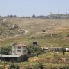
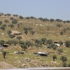
West of Beit Hanina al-Balad
Abu Dahouk - Beit Hanina
Resident
Number of Families
29
Tribe
testing the tooltip
Jahalin
Sub-Tribe
Abu Dahouk
Names of Families
Abu Dahouk
Farmers Origin/Family
Be'er Sheva
Refugees
official refugee status
Refugees Details
They are recognized by UNRWA and carry official refugee cards
Spatial/Building
Land Ownership
- private
- lease
- state owned land
Land Ownership - details
At least one person bought land from Beit Hanina owners adjacent to area B
Planning
No plan
Structure Type
- tent
- tin shack
- EU shack
- wood
Building materials - details
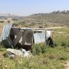
The houses donated by the EU are not used by the community for housing since they are unsuitable: they become very hot in the summer and very cold in the winter. The community moved the EU houses to area B, to protect them.
Infrastructure/Services
Access to Community
- pedestrian
- private vehicle
Water Access
connection to neighboring village
Water Access - details
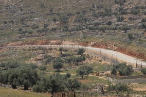
Original water sources are under Israeli territory since the building of the separation barrier. Following the building of the barrier the community built a water pipe, and was able to be connected to the spring and their wells behind the separation barrier, but this has been cut off. Today they have a filling point in area B, in the local council of Beit Hanina. The community pays high prices for water, and are in debt to the Palestinian water authorities, who collect the money through the council of Beit Hanina. The communiny asks to create a water system that serves the whole community.
Electric Connection
Electric Connection - details
The community is connected to private houses in Area B, and they pay high electricity rates. There is a high pressure on energy supplies that causes disconnections, especially in winter times. The community raised a need to be connected to solar panels.
Health Care
clinic in neighboring community
Health Care - details
The neighboring village has a clinic and nurse. The nearest hospital is in Ramallah. As refugees they can also be referred to the UNRWA hospital in Jerusalem, and UNRWA covers about 70% of the treatment. Inhabitants say that for complicated and expensive treatments the costs are impossible for them to pay, even after the UNRWA funding.
Location of Services
The nearest hospital is in Ramallah. As refugees they can also be referred to the UNRWA hospital in Jerusalem.
Education
Kindergarten
No
Location of School #1
Beit Hanina
general description [school #1]
- Girls
- Primary school
- Middle school
- High School
Distances to schools [school #1]
2001 - 5000 meters
Location of School #2
Beit Hanina
Time to schools [school #1]
16 - 30 minutes
general description [school #2]
- Girls
- Middle school
- High School
Time to schools [school #2]
16 - 30 minutes
Distances to schools [school #2]
more than 5001 meters
general description [school #3]
High School
Distances to schools [school #3]
1001 - 2000 meters
Time to schools [school #3]
5 - 15 minutes
Travel to school [school #1]
- easy walk
- difficult walk
Travel to school [school #2]
- easy walk
- difficult walk
Travel to school [school #3]
- easy walk
- difficult walk
Accessibility to school [school #1]
3
Accessibility to school [school #2]
6
Accessibility to school [school #3]
4
History
History
The community is originally from Tel-Arad, Be'er Sheva. They arrived to Khan Al-Ahmar following their expulsion in 1948. Most of them were registered as residents of Al-Eizariya. Due to some inconsistencies in registration process, some were registered as residents of Im Rassas.
livelihood
Seasonal Movement
no
Seasonal Movement - details
In the past, the community used to move freely from Beit Hanina to Khan Al-Ahmar through the French Hill. This has become impossible since the separation wall was built, and the movement has been stopped completely since 2004.
Community Initiatives
no Initiatives
Other Occupation
- shepherding
- herd without shepherding
- permanent employment in Palestinian town
- employed by PA
Main Occupation
- shepherding
- herd without shepherding
- employed by PA
Woman's Occupation
- taking care of the herd
- taking care of the kids
- housekeeping
- agriculture
General Livelihood - details
The elder generations are mostly shepherds. Younger generations work as farmers in the Jordan valley or in various positions in the PA. Since grazing grounds and marketing areas were substantially reduced after the building of the separation barrier, the shepherds must buy a lot more industrial food for their herds. This caused barley prices to increase and today one ton of barley costs 1200-1500 NIS (before the separation barrier: 700 NIS).
Many of the inhabitants did not get work permits from the Israeli authorities, and so they are unable to find work in Israeli territories.
Many of the inhabitants did not get work permits from the Israeli authorities, and so they are unable to find work in Israeli territories.
Threats and obstacles
Threats and Obstacles
fjfxjsfjsyjsyj
- nature reserve
- archeology
- separation barrier
- Wastewater treatment facility
Threats and Obstacles - details
The western part of the village suffers from sewage water from Ramot that flood the area, since settlers cut off the stream to keep the water in the Bedouin area. This creates a severe environmental danger since the water bring with it mosquitoes and mice, as well as pollute the natural ground water.
During the winter the wadi is flooded, which blocks the access road to the village. This prevents, among other things, children from reaching their schools. The community asked for draining holes to be excavated under the road, but as the area is not under Palestinian control, the request was left unanswered and the situation is not resolved.
During the winter the wadi is flooded, which blocks the access road to the village. This prevents, among other things, children from reaching their schools. The community asked for draining holes to be excavated under the road, but as the area is not under Palestinian control, the request was left unanswered and the situation is not resolved.
Number of Demolition Orders
13
Demolitions - details
According to the residents demolitions took place in 6.11.14.
New demolition orders were given in January 2015.
New demolition orders were given in January 2015.

