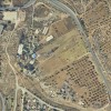
South Hebron Hills, along Road 316
A Seefer
Resident
Number of Families
15
Names of Families
Mor, Rshed, Abu Zahra, Abu Qbeida
Refugees
not refugee
Spatial/Building
Land Ownership
private
Planning
No plan
Structure Type
- concrete
- stone
Infrastructure/Services
Access to Community
- pedestrian
- private vehicle
- 4X4 vehicle
Access to Community - details
The community is located behind the check point and next to the settlement of Metzadot Yehuda.
The route of the separation barrier ends just next to one side of the checkpoint and families that don't have permits to enter have to make a bypass through a dirt road.
The route of the separation barrier ends just next to one side of the checkpoint and families that don't have permits to enter have to make a bypass through a dirt road.
Water Access
- water tank
- cistern\well
Water Access - details
Water tanks are brought from Israel, as Palestinian vehicles are not allowed to pass the checkpoint. This causes water prices to be substantially higher than normal: 800 NIS per tank, instead of 100 NIS.
On their land there are water pools and pipes which are under the use of the settlers, and the community is prohibited from using them.
On their land there are water pools and pipes which are under the use of the settlers, and the community is prohibited from using them.
Electric Connection - details
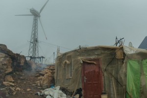
Solar panels were provided by Comet-ME.
Health Care
- mobile clinic in community
- clinic in neighboring community
- clinic in distant town/village
Health Care - details
The community visits clinics in in Imnaizel and Yatta.
Location of Services
Imnaizel and Yatta
Education
Kindergarten
yes
Location of School #1
Imnaizel
general description [school #1]
- Boys
- Girls
- Primary school
- Middle school
- High School
Distances to schools [school #1]
1001 - 2000 meters
Time to schools [school #1]
16 - 30 minutes
Schools - details
Buses are not allowed to enter the community, so children get to school by foot or a car provided by the PA.
Travel to school [school #1]
difficult walk
Accessibility to school [school #1]
3
History
History
A Seefer was established during the Ottoman era.
livelihood
Seasonal Movement
no
Community Initiatives
woman employment
Initiative in the community - details
The women of the community are trying to start an organization
Other Occupation
shepherding
Main Occupation
shepherding
Woman's Occupation
- taking care of the herd
- housekeeping
Threats and obstacles
Threats and Obstacles
fjfxjsfjsyjsyj
- close to settlement
- within settlement municipal boundary
- settler violence
- separation barrier
Threats and Obstacles - details
The grazing area is right by the outpost of Yaakov Talia, which causes confrontation and violence on a daily basis. The separation barrier blocks the village from the rest of the South Hebron Hills. The villagers have permits to cross through the checkpoint.
Number of Demolition Orders
34
Number of Demolitions
11
Demolitions - details
The last demolition took place in 2015, but they according to the community, the entire village is currently under threat of demolitions.

