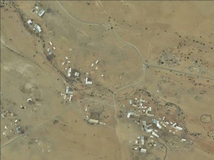
Jordan Valley, along Road 449
Ras 'Ein al 'Auja - Yatta
Spatial/Building
Land Ownership
private
Land Ownership - details
The land is all privately owned by families in Al-A'uja, the community does not pay any lease money.
Planning
No plan
Structure Type
- tent
- tin shack
- wood
Infrastructure/Services
Access to Community
- pedestrian
- private vehicle
- public transit
Access to Community - details
Public transportation runs from A'uja. A bus provided by the PA collects the students of the community to schools.
Electric Connection - details
Several solar panels were installed by the Ma’an Foundation. The panels provide 2-3 hours of weak electricity in the evenings after charging the batteries all day. The electricity is only sufficient to run a television or small refrigerator, and does not contribute to the production of dairy products.
Health Care
- mobile clinic in community
- clinic in distant town/village
Health Care - details
A mobile clinic arrives to the village once a month. The closest hospital is in Jericho. The nearest clinic is in A'uja village.
Location of Services
Jericho and al Auja
Education
Kindergarten
No
Kindergarten - details
A kindergarten was opened for limited time and was run by women from the community. The donors stopped to fund it and no salaries were paid and so it closed down.
Location of School #1
Al 'Auja - UNRWA
general description [school #1]
- Boys
- Girls
- Primary school
- Middle school
Distances to schools [school #1]
1001 - 2000 meters
Location of School #2
Al A'uja - Goverment
Time to schools [school #1]
16 - 30 minutes
general description [school #2]
- Boys
- Girls
- High School
Time to schools [school #2]
16 - 30 minutes
Distances to schools [school #2]
1001 - 2000 meters
Location of School #3
Ein Asultan - UNRWA
Distances to schools [school #3]
more than 5001 meters
Location of School #4
Nuweia'ma
Time to schools [school #3]
31 minutes - 1 hour
general description [school #4]
- Boys
- Girls
- Primary school
- Middle school
- High School
Distances to schools [school #4]
more than 5001 meters
Location of School #5
Masqat
Time to schools [school #4]
31 minutes - 1 hour
general description [school #5]
- Girls
- High School
Distances to schools [school #5]
more than 5001 meters
Time to schools [school #5]
31 minutes - 1 hour
Travel to school [school #1]
- bus
- difficult walk
Travel to school [school #2]
- bus
- difficult walk
Travel to school [school #3]
private car
Travel to school [school #4]
private car
Travel to school [school #5]
private car
Accessibility to school [school #1]
3
Accessibility to school [school #2]
3
Accessibility to school [school #3]
6
Accessibility to school [school #4]
6
Accessibility to school [school #5]
6
livelihood
Community Initiatives
tourism
Threats and obstacles
Threats and Obstacles
fjfxjsfjsyjsyj
- firing zone/closed military zone
- nature reserve
- close to settlement
- settler violence
Threats and Obstacles - details
The army sometimes come at night to the community to search. The community reports that the settlers from the nearby settlements have intimidated shepherds and have stolen, shot and killed several sheep and donkeys.
Number of Demolition Orders
26
Number of Demolitions
1


