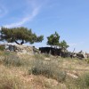
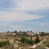
south of Hebron along Road 356
Birin
Resident
Number of Families
70
Tribe
testing the tooltip
A'zazmeh
Names of Families
Azazmeh, Makhamreh, burkan, Al Faquir
Farmers Origin/Family
The Fallahin are from Yatta, the Bedouins are refugees from Anaq area, and from Bani Nai'm
Refugees
- not refugee
- official refugee status
Spatial/Building
Land Ownership
- private
- lease
Land Ownership - details
Some of the lands were purchased by the community in 1984-5. The rest is owned by inhabitants of Hebron and surrounding villages.
Planning
No plan
Structure Type
- tent
- tin shack
- concrete
- stone
Infrastructure/Services
Access to Community
4X4 vehicle
Access to Community - details
The community is accessible only through one dirt road, which is in a bad state. Other roads are blocked.
Water Access
- water tank
- cistern\well
Water Access - details
Water tanks are purchased from Yatta and Al-Baqa'a
Electric Connection - details
in 2017 they were donated a project of solar panels by the Spanish cooperation, An-Najah University, and PARC.
Health Care
- mobile clinic in community
- clinic in neighboring community
- clinic in distant town/village
Health Care - details
The community receives health care in Bani Naim or in Hebron, which they reach by taxis. The minisytry of health donated a medical center in the village but this received a demolition order from the ICA. There is a medical staff available every Monday.
Location of Services
Hebron
Education
Kindergarten
No
Location of School #1
Birin
general description [school #1]
- Boys
- Girls
- Primary school
- Middle school
Distances to schools [school #1]
301 - 1000 meter
Location of School #2
Bani Nai'm
Time to schools [school #1]
5 - 15 minutes
general description [school #2]
- Boys
- Girls
- Middle school
Time to schools [school #2]
31 minutes - 1 hour
Distances to schools [school #2]
more than 5001 meters
Location of School #3
Bani Nai'm
general description [school #3]
- Boys
- Girls
- High School
Distances to schools [school #3]
more than 5001 meters
Time to schools [school #3]
31 minutes - 1 hour
Travel to school [school #1]
- easy walk
- difficult walk
Travel to school [school #2]
- bus
- difficult walk
- private car
Travel to school [school #3]
- bus
- difficult walk
- private car
Accessibility to school [school #1]
3
Accessibility to school [school #2]
6
Accessibility to school [school #3]
6
History
History
The community is originally from the Bir Esbea' (Be'er Sheva) area. They were expelled to Hebron and from there arrived to Bani Naim
livelihood
Seasonal Movement
yes
Seasonal Movement - details
A few of the families move during two months in the winter to graze areas near Arashaydeh.
Initiative in the community - details
The village has a volunteer committee
Other Occupation
- shepherding
- daily laborer
- agriculture
Main Occupation
- shepherding
- daily laborer
- agriculture
Woman's Occupation
- taking care of the herd
- taking care of the kids
- housekeeping
General Livelihood - details
The Bedouin community relies mostly on their herds for income while the farmers rely on agriculture, growing mainly wheat and olives
Threats and obstacles
Threats and Obstacles
fjfxjsfjsyjsyj
- close to settlement
- settler violence
- road
Threats and Obstacles - details
According to the community, shepherds who use their grazing areas close to the settlement Bani Naim are exposed to threats, violence and arrests from the settlers and the IDF.
They receive repeated demolition orders,
The entrance to Bani Na'im is often closed and controlled by the army, which prohibits the students from reaching their schools in Bani Nai'm.
They receive repeated demolition orders,
The entrance to Bani Na'im is often closed and controlled by the army, which prohibits the students from reaching their schools in Bani Nai'm.
Number of Demolition Orders
51
Number of Demolitions
15
Demolitions - date of update
September 17, 2010
Demolitions - details
According to residents, demolitions took place in 2008 and in 2014 (twice).

